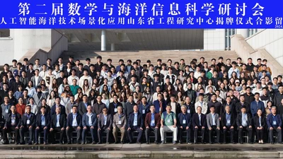
第二届数学与海洋信息科学研讨会暨人工智能海洋技术场景化应用山东省工程研究中心揭牌仪式在山东青岛成功举办
2024年11月14日-16日,由青岛科技大学、中国海洋学会人工智能海洋学专业委员会、国际数字地球学会中国数字海洋专业委员会共同主办,青岛科技大学数理学院、中国海洋大学信息科学与工程学部、自然资源部第一海洋研究所、青岛阅海信息服务有限公司、人工智能海洋技术场景化应用山东省工程研究中心承办,青岛市人工智能海洋技术创新中心、青岛海慧智风能源科技有限公司协办的第二 …
管理员
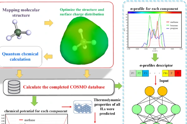
A selection of recent papers
2024年11月14日-16日,由青岛科技大学、中国海洋学会人工智能海洋学专业委员会、国际数字地球学会中国数字海洋专业委员会共同主办,青岛科技大学数理学院、中国海洋大学信息科学与工程学部、自然资源部第一海洋研究所、青岛阅海信息服务有限公司、人工智能海洋技术场景化应用山东省工程研究中心承办,青岛市人工智能海洋技术创新中心、青岛海慧智风能源科技有限公司协办的第二 …
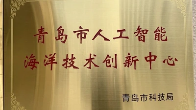
一、基本情况 青岛市人工智能海洋技术创新中心(以下称创新中心)于2022年8月由青岛市科学技术局批准成立。该中心由数理学院牵头,依托数学、统 计学硕士一级学科及“数学与海洋信息科学”省重点扶持储备学科,联合海洋科学与生物工程学院、信息科学技术学院及青岛阅海信息服务有 限公司共同建设,围绕国家海洋发展战略,服务区域经济社会发展,着力打造一个数学、人工智能、海洋 …
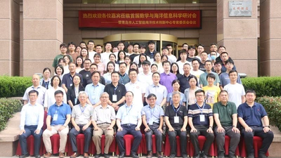
2023年7月6日-8日,“首届数学与海洋信息科学研讨会暨青岛市人工智能海洋技术创新中心专家委员会会议”在青岛大公岛酒店成功召开。 青岛科技大学党委常委、副校长罗细亮教授在开幕式上致辞,他介绍了学校的发展历史、办学格局、学科特色等,肯定了本次会议对学校学科建设和发展的积极作用,并预祝大会圆满成功。中国海洋学会人工智能海洋学专委会主任、南京信息工程大学海洋科学 …
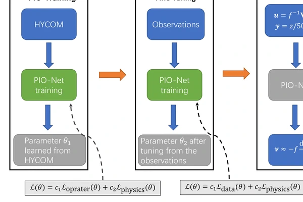
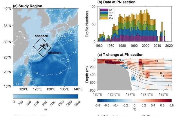
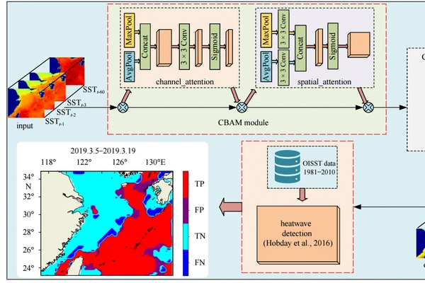
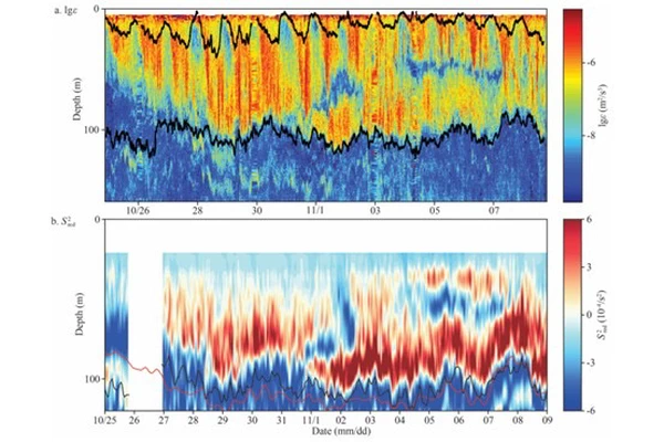
针对当前气候模式模拟共性偏差问题,自然资源部第一海洋研究所通过引入小尺度海浪在海洋混合和海气通量上的作用,发展了两代耦合海浪的地球系统模式FIO-ESM,能够有效减缓模拟偏差,提高模拟和预测能力。本报告将围绕耦合海浪分量模式这一特色,以FIO-ESM模式中引入的浪致混合、斯托克斯漂流对海气通量作用、海浪飞沫对热通量作用和海表温度日变化过程等4种特色物理过程为 …

尚华哲,中国科学院空天信息创新研究院研究员,从事云宏观参量和微物理参量多角度偏振遥感反演及应用研究。担任青年科学基金(B类,原优青项目)、国家重点研发青年科学家项目等负责人。在大气遥感和大气物理等领域核心期刊Remote Sensing of Environment、Atmospheric Chemistry and Physics等发表SCI论文40余篇。 …

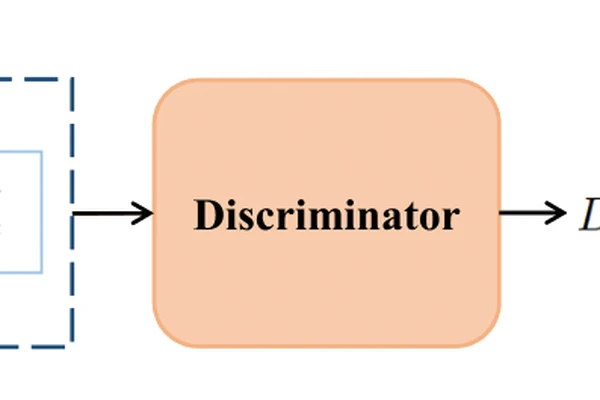
近年来,多视图大规模数据因其能够表达多种属性和分布特征而受到广泛关注。然而,传统基于非负矩阵分解(NMF)的多视图聚类方法通常在所有视图之间强制共享统一的表示矩阵,或是分别对各视图独立进行NMF分解后再融合所得的表示矩阵。这类方法往往忽略了视图间潜在的关联信息。为克服上述局限性,我们提出了一种面向一步式多视图聚类的正交非负张量分解方法(ONT-FOMC)。该 …
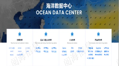
采用大数据、分布式、云计算等先进技术建立北海区海洋秘学大数据中心,实现海洋环境观测、海洋卫星遥感、海洋环境预报、海洋灾害警报、海洋应急决策、再分祈产品、渔船动态信息、海洋地理信息等核心业务数据的统一存储、高效查询检索和应用。
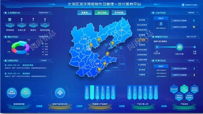
面向自然资源部北海预报减灾中心、大连、秦皇岛、天津、烟台、日照海洋中心等机构用户提供海洋预警报制作业务,打通并实现全海区各预报机构之间的一体化、链条化应用,并为全国范围内的海洋预警报制作业务一体化建设提供示范。
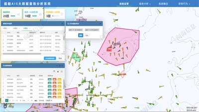
设计AIS、雷达、北斗等不同数据源,使用海量船舶数据的分布式存储方案,实现数据的高效存储和快速时空检索,同时针对不同的应用场景,实现多源船舶数据的融合,船舶航速分析、多源航迹匹配、重点海域船舶异常行为分析等相关功能。